thoughts and ideas:
It is always important when giving back public space to the community to be sure that the spaces are designed in such a way that they can used to there full potential. If the Brisbane City Council was to pedestrianise some of the streets in Brisbane's CBD, the design and functions of the spaces would have to be thought through with considered of what the users need in Brisbane city. What is missing from the streets? How can we activate them with architecture so that they dont just become a pedestrian heavy thoroughfare like Queen street Mall?
Change in street scape and change in topography would be high necessary to create more usable spaces for relaxing and 'hanging around'. Workers and people in the city currently have no where to sit and relax away from the hustle and bussle of the cities thoroughfares. Queen Street is already a pedestrian mall in the city which I believe does not work so well in terms of its use.

This pedestrian mall is alway packed full of people trying to get from A to B, and it exhibits a heavy flow of thoroughfare traffic. It is not a comfortable or relaxing place to sit down and have a break.
That is exactly why I want to create a street scape that invites variation in the topography to create a space that can be used to its full potential beyond a pedestrian thoroughfare.
The use of this street should be appropriate for future users.
The diagram below maps the access points of important roads into the city. Through mapping these access points I was able to strategically and educatedly decide on appropriate streets to pedestrianise.
site selection process
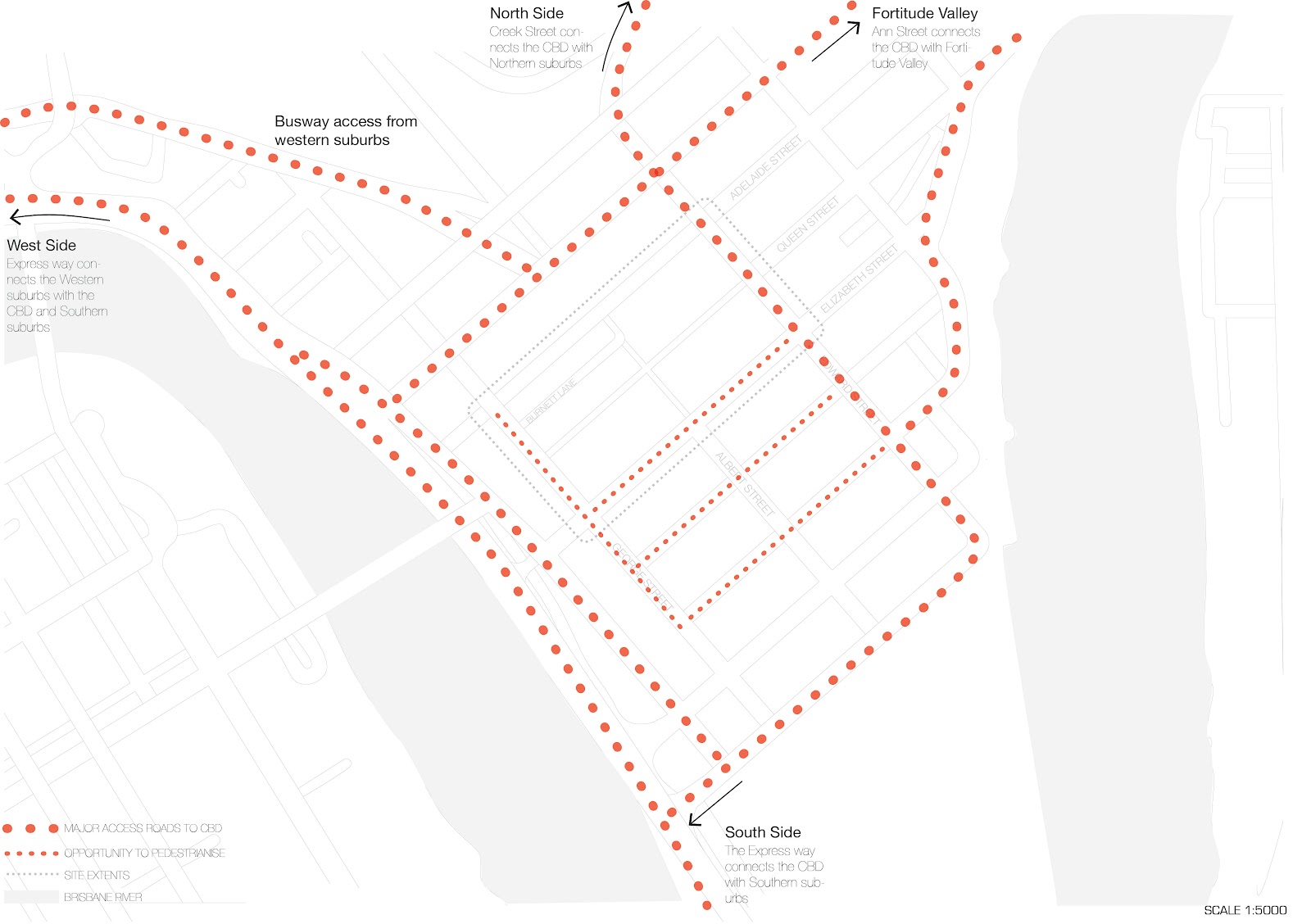
CBD Access and Major Roads
Elizabeth, Charlotte, Mary and George Streets were selected. If pedestrianised, all of these streets would not create much obstruction to traffic flow, especially if an underground train system could cater for delivering 50% of people into the city. The pedestrianised areas could possibly keep on extending, with further development of the underground.

source: http://www.brisbane.qld.gov.au/documents/plans_strategies/City%20Master%20Plan/public_domain3.pdf
The map above shows an interesting analysis of brisbane city which show the direct axis from the botanical gardens to roma street parklands. It calls these streets the park streets and the ones which run opposite these the river streets. It would be interesting to actually create pedestrian streets in the river streets so the people would have an axis connection with the river.
No comments:
Post a Comment